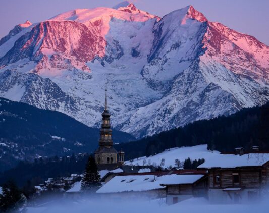
✦ In brief
- GSI by Foncia resorts offer hundreds of kilometres of marked trails in the Northern Alps, accessible to all levels from June onwards.
- Each destination suits several profiles: easy family walks, intermediate day hikes, and sportier routes for experienced walkers.
- Elevation gain, duration and distance data are sourced from local tourist offices and trail managers.
- Each section includes a direct link to GSI rentals in the relevant destination to help you plan your mountain hiking holiday.
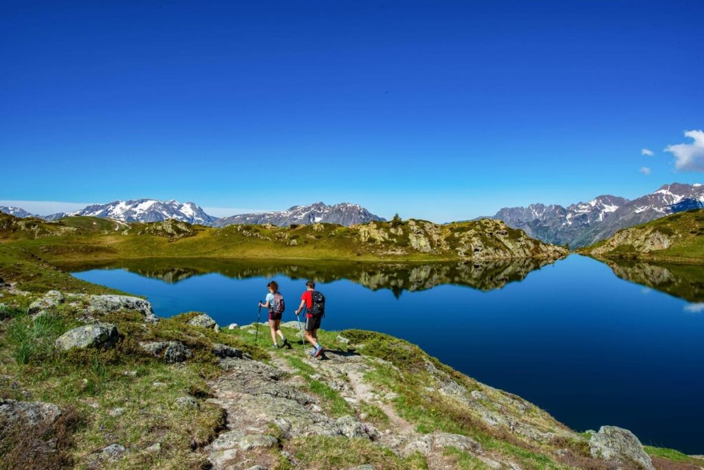
In summer, the mountains are first and foremost an invitation to walk. In the Northern Alps, GSI by Foncia resorts each offer a network of marked trails that can easily rival France’s leading hiking destinations: easy routes accessible to young children, intermediate loops rewarded by panoramic views of Mont Blanc or the Vanoise glaciers, and a few more demanding outings for hikers looking for pure mountain air without compromise.
This guide lists the most remarkable hikes in each GSI destination, with real elevation gain, duration and difficulty data taken from tourist offices and local trail managers. For every destination, a direct link to GSI rentals helps you organise your hiking holiday right away.
Alpe d’Huez — Grandes Rousses Massif
An iconic resort in Oisans, Alpe d’Huez is also one of the richest hiking destinations in the French Alps. In summer, the lifts — especially the Pic Blanc gondola — provide access to more than 2,700 m in altitude and open up a wide range of routes between glacial lakes, alpine pastures and 360° views over the Écrins and Belledonne massifs. More than 100 marked trails are accessible between June and October. Book your rental in Alpe d’Huez to enjoy this exceptional hiking playground.
⏱️ 2h30
⬆️ 150 m
👨👩👧 All ages
The great Alpe d’Huez classic, suitable for all levels including children from around 6 years old. Starting from Chalet Besson (1,750 m), the route links five high-altitude lakes in an open mineral landscape, with views over the Belledonne and Taillefer massifs. Very low elevation gain and a well-marked trail all along the route.
⏱️ 1h one way
⬆️ Flat
🍼 Pushchair-friendly
Starting from Lac des Bergers (1,796 m), this easy walk follows the road towards Col de Sarenne through alpine pastureland. You will often come across sheep flocks and the Brandes archaeological site. Accessible even with a pushchair, with picnic tables along the route. Open from 1 May to 30 November.
⬆️ 400 m
🧗 Equipment available
One of the most renowned via ferratas in the Northern Alps, accessible directly from the resort. The route is varied, with cable-secured sections, monkey bridges and traverses on ledges offering spectacular views over the Romanche valley. Equipment (harness and lanyard) can be rented locally. Ideal from age 12 upwards with good physical fitness.
Les Saisies — Beaufortain
An open plateau facing Mont Blanc, Les Saisies is an ideal hiking base for families. With 65 km of marked trails within the commune, 16 family walks listed by the tourist office, and 3 summer lifts providing access to higher viewpoints, the resort offers a complete range of routes through alpine pastures, peat bogs and panoramic ridges. It can also be combined with hikes in the neighbouring Beaufortain area, such as Lac de Roselend or Lac de Saint-Guérin. Discover the available rentals in Les Saisies for your stay.
⏱️ 1h15
⬆️ Almost flat
👨👩👧 From age 4
A short family trail on boardwalks winding through the largest peat bog in the Alpine arc, nicknamed “little Lapland”. Dragonflies, toads, bats and carnivorous plants all live in this protected environment. A game booklet is available from the tourist office to keep children engaged. Departure from the Maison de la Tourbière.
⏱️ 2h
⬆️ 90 m from the chairlift
🚡 Optional chairlift
From the top of Chard du Beurre, a natural terrace opens onto Mont Charvin, Mont Blanc and the Aravis with a 360° panorama. Elevation gain is minimal when taking the chairlift from the resort — only 90 m — and the trail follows the ridge almost flat, perfect for children who want a “real mountain” experience without an exhausting effort. Information panels punctuate the route.
⏱️ 3h30
⬆️ 400 m
👁️ 360° view
On the slopes of Bisanne, the walking trail climbs gently through alpine pastures and woodland to the summit of Mont Bisanne (1,941 m). At the top, a spectacular 360° view takes in the Aiguilles Rouges, Mont Blanc, the Beaufortain, the Aravis, the Pierra Menta, the Vanoise and the Chartreuse. Suitable for good walkers with children aged 10 and over.
⏱️ 2h30
⬇️ 500 m descent
🚌 Shuttle return
From the centre of Les Saisies, the descent to Hauteluce offers a balcony route with views over the Beaufortain, the Hauteluce valley and the Mont Blanc massif. The pretty village of Hauteluce is worth a stop, with two restaurants on site. Return shuttle available in season. This is a one-way hike, entirely downhill.
Le Grand-Bornand — Aravis
Le Grand-Bornand has one of the most complete hiking networks in the Aravis, with 160 km of marked trails between the village and the summits. In summer, the Lachat chairlift and Rosay gondola open high-altitude routes to walkers that would otherwise be harder to reach. The Aravis mountain guides and hiking leaders offer guided outings throughout the week for all levels. Rent an apartment in Le Grand-Bornand for a week of hiking.
⏱️ 1h30
⬆️ 150 m
🐟 Picnic by the water
From the hamlet of Samance in Grand-Bornand Chinaillon, this short and easy route leads to the pretty Lac de la Cour via the Chemin du Lac. Well-marked trail, picnic tables and a small lakeside refreshment stand in summer. Ideal for a first family walk or a relaxed late-afternoon outing.
⏱️ 1h
⬆️ Almost flat
🌊 Guaranteed freshness
A shaded walk along the Nant du Chinaillon, ideal on hot summer days. The Mysterious Waterfall is a thirty-metre-high cascade in a narrow gorge, linked to a local legend. The trail is entirely under forest cover and is particularly pleasant with young children. One of the resort’s most popular “cool-down” routes.
⏱️ 3h
⬆️ 372 m
⛰️ Aravis view
From Chinaillon, this trail climbs to the alpine pastures of the ski area and reaches Col de Châtillon, where the view of the Aravis range is breathtaking: Roc des Charmieux, Aiguille Verte and Jallouvre. Picnic break at the col, then a gentle descent back along the same route. Suitable for good walkers with children aged 8 and over.
⏱️ 6h
⬆️ 1,248 m
🏔️ Exceptional panorama
The major hike of Le Grand-Bornand, rated 4.7/5 on AllTrails with 27 reviews. The route climbs to Lac de Lessy, then reaches the ridges up to Dent de Jallouvre (2,408 m), one of the iconic summits of the Aravis. 360° panorama over Mont Blanc, the Beaufortain, the Bargy and the Bauges massif. Reserved for experienced hikers in good physical condition.
Méribel & Méribel-Mottaret — Vanoise
Méribel and Méribel-Mottaret provide access to one of the most varied hiking areas in the Alps. In the heart of the Vanoise Natural Park, the marked trails lead to glacial lakes, flower-filled alpine pastures and exceptional viewpoints over surrounding glaciers and peaks such as Grande Casse and Mont du Vallon. In summer, several lifts open to walkers, making the high-altitude plateaus easier to reach. GSI by Foncia offers rentals in Méribel and rentals in Méribel-Mottaret close to the trails.
⏱️ 1h30
⬆️ 80 m
🌲 Larch forest
Starting from the Plan Ravet car park in Mottaret, this trail follows Lac de Tuéda through a nature reserve surrounded by centuries-old larch trees. Turquoise water, silence, marmots and protected alpine flora. Swimming is forbidden in the lake, but simply walking around this listed site is well worth it. Ideal for all levels, including very young children.
⏱️ 5h to 5h30
⬆️ 930 m
💙 Lake at 2,541 m
A more demanding day hike from Plan Ravet, climbing via Col du Vallon to Lac du Vallon (2,541 m), a glacial lake set in a wild landscape. The climb follows a sometimes faint path and scree sections: it is best kept for good walkers and is not recommended for children under 12 according to experienced hikers. Exceptional panorama at the col.
⏱️ 5h to 6h
⬆️ ~1,200 m
🏔️ 3 Vallées high point
The highest point of the 3 Vallées ski area at almost 3,000 m, Mont du Vallon offers a breathtaking panorama over the Gébroulaz glacier, Grande Casse, the Aiguilles du Borgne and, in clear weather, Mont Blanc. The route follows a marked trail to the pre-summit. The final access to the true summit is airy and on unstable rock, so it is optional.
Champagny-en-Vanoise — Vanoise National Park
A gateway to Vanoise National Park — France’s oldest national park, with 107 summits over 3,000 m — Champagny-en-Vanoise is an outstanding hiking destination. The park’s marked trail network covers 400 km and gives access to wild glacial valleys, authentic refuges and remarkable wildlife such as ibex, marmots and chamois. GSI by Foncia offers rentals in Champagny-en-Vanoise, an ideal base for exploring the heart of the Vanoise. The local tourist office also organises guided themed hikes.
⏱️ 1h15 one way
⬆️ 127 m
🦫 Frequent marmots
Starting from the La Couaz car park (1,445 m), this gentle trail follows the Doron de Champagny to Laisonnay d’en Haut, marking the entrance to the National Park. It crosses the five picturesque hamlets of the listed valley: La Couaz, La Chiserette, Le Bois, Friburge and Le Laisonnay. Marmots and ibex are regularly seen on the south-facing slopes. Accessible from age 4.
⏱️ 1h35
⬆️ Low
🎣 Trout and salmon
A loop from Champagny-en-Vanoise following the Doron stream through the Mont Jovet state forest. The Doron de Champagny is a lively mountain stream, home to trout and salmon, with clear, highly photogenic waters. A woodland route that is especially pleasant on hot summer days thanks to the natural shade.
⏱️ 3h30
⬆️ ~500 m
💎 Vanoise glacier views
A day hike leading to a beautiful mountain lake with open views over the Vanoise Massif, Grand Bec and the glaciers. The well-marked trail crosses green pastures and flower-filled areas in July. Suitable for families with children aged 10 and over who already have some hiking experience.
⏱️ 5h to 6h
⬆️ ~700 m
💧 80 m waterfall
From the Laisonnay d’en Bas car park (1,560 m), this trail follows the Cascade du Py, an 80-metre waterfall, up to Refuge de Plaisance (2,160 m), where the view over the Grand Bec massif is remarkable. One of the best-rated hikes in the area, with a 4.4/5 score on AllTrails. The beginning of the route can be steep.
Praz-sur-Arly & Val d’Arly
Nestled between Megève and Flumet in the Val d’Arly, Praz-sur-Arly offers an original hiking area with themed family trails including treasure hunts, comic-style topo guides and nature games, as well as panoramas over the Aravis, Beaufortain and Mont Blanc. The Crêt du Midi chairlift is open to walkers in summer and gives access to 1,700 m without effort. GSI rentals in Praz-sur-Arly let you stay in this authentic Val d’Arly village, close to lakes and trails.
⏱️ 1h15
⬆️ 190 m
🏘️ Alpine farms
A panoramic balcony circuit facing Mont Blanc and the Val d’Arly, passing through old alpine farms before dipping into a forested section. Open views over the whole Val d’Arly with the Mont Blanc massif in the background. Accessible to the whole family from a young age. One of the resort’s three “Tétras Randos” trails.
⏱️ 1h50
⬆️ 270 m
🌲 Shaded
A mostly forested route from Praz-sur-Arly leading to the banks of a small mountain lake. The natural shade makes it an ideal option on hot summer days. Accessible from age 6. Also part of the Tétras Randos, with a summit diploma for young hikers.
⏱️ 2h45
⬆️ 450 m, or 253 m from the chairlift
👁️ Aravis, Beaufortain, Mont Blanc
One of the highest summits in Praz-sur-Arly (1,983 m), offering a 360° view of the three surrounding massifs: Aravis, Beaufortain and Mont Blanc. Taking the Crêt du Midi chairlift from the resort reduces the remaining elevation gain to only 253 m. Recommended for walkers with a basic level of fitness.
Megève — Évasion Mont-Blanc
Megève is one of the few Alpine resorts where walks can start directly from the heart of the pedestrian village, without a car and from early morning. Beyond the gentle walks around the village, the Évasion Mont-Blanc area offers high-altitude trails with remarkable views of the Mont Blanc massif. GSI by Foncia offers rentals in Megève in the heart of the village, within walking distance of the main trailheads.
⏱️ 45 min
⬆️ Flat
🍼 Pushchair possible
A heritage walk in the heart of Megève village, following the fountains and streams that shaped its history. Recommended for people with reduced mobility and families with babies. Pushchair-friendly, entirely within the village, with heritage discovery points along the way.
⏱️ 1h30
⬆️ 220 m
⛳ Golf and Mont Blanc view
A family walk through alpine pastures and meadows with panoramic views over the Megève golf course and the Mont Blanc massif. An orientation table at Mont Joux helps identify the surrounding peaks. The trail passes one of the last working farms surrounded by alpine flowers such as gentians, primroses and buttercups.
⏱️ 3h30
⬆️ ~450 m
🌄 360° view
From Praz-sur-Arly or Megève, Christomet is a natural belvedere offering a 360° view over the Aravis and the Mont Blanc massif. Most of the trail is shaded, making it a popular option on hot summer days. Suitable for families with children aged 10 and over who are used to walking.
Valmorel — Grand Domaine
A pedestrian resort by design, Valmorel lets hikers set off directly from their apartment without taking the car. The surrounding larch forests and Tarentaise alpine pastures form a calm, preserved walking area. Several wooded trails start from the village itself, with views gradually opening over the valley as you climb. GSI by Foncia offers rentals in Valmorel in the heart of the pedestrian resort.
⏱️ 1h30
⬆️ 150 m
🌲 Shaded
From Valmorel, the Doucy-Combelouvière sector, a neighbouring hamlet, opens onto quieter alpine pastures, with larch woodland trails ideal for a peaceful walk. Very pleasant at midday thanks to the natural shade. Calm terrain, not very busy even in the middle of the summer season.
⏱️ 3h30
⬆️ ~500 m
🐄 Alpine herds
From the pedestrian centre of Valmorel, several routes climb towards the Tarentaise alpine pastures, gradually opening panoramic views over the resort and the surrounding valley. Along the way, herds of dairy cows from the Tarine breed graze in the meadows. The Valmorel tourist office provides detailed topoguides for the local routes.
Practical tips to prepare your mountain hike
🎒 Essential equipment
- High-cut hiking shoes: trainers are not enough on rocky terrain and wet trails
- Layered clothing: technical base layer, light fleece and waterproof windbreaker, even in good weather at altitude
- At least 1.5 litres of water per person: high-altitude springs and fountains are often drinkable but unpredictable
- SPF 50+ sunscreen and sunglasses: UV radiation is significantly stronger above 1,500 m
- Energy snacks such as cereal bars, dried fruit or local cheese for outings of 3 hours or more
- Charged phone with the mountain rescue numbers, 15 or 112, saved
🗓️ When to set off and how to prepare
- Check Météo-France every morning before leaving: storms form quickly in late morning during summer
- Start early, before 8:30 a.m. for sporty hikes, so you can be back down before afternoon storms
- Always tell someone your planned route and expected return time
- If you are unsure about the route, local tourist offices and mountain leaders are the best resources
- Trails in Vanoise National Park are free: no entrance pass is required for walkers
Mountain hiking is accessible to all levels as long as you choose a route suited to your group and physical condition. Each tourist office in the GSI destinations listed above offers outings led by qualified guides, which are especially useful for a first discovery of the area or for families who want professional supervision.
To choose your accommodation in one of these destinations and organise your week of hiking, browse GSI by Foncia summer rentals in the Northern Alps. Every apartment or chalet is managed by a local team present year-round, able to guide you towards the best routes for your level and travel dates.
Plan your hiking holiday in the Alps
Apartments and chalets close to the trails, managed by local teams present all year round. Book in GSI’s 17 Northern Alps destinations.
Best price guaranteed — local teams available for hiking advice
FAQ: hiking in Alpine resorts
What is the best period for hiking in the Northern Alps?
The hiking season in the Northern Alps generally runs from mid-June to late September. July and August offer optimal conditions for high-altitude trails, with snow-free paths, open refuges and alpine flora in full bloom. Late August and September bring fewer people on the most popular trails, with autumn colours on the larch trees from mid-September onwards. Conditions vary depending on altitude and the year: always check trail conditions with local tourist offices before setting off.
Which GSI destination should you choose for hiking with young children?
Les Saisies, with the peat bog and Chard du Beurre via chairlift, Praz-sur-Arly, with themed trails including comic guides and treasure hunts, Le Grand-Bornand, with Lac de la Cour and the Mysterious Waterfall, and Champagny-en-Vanoise, with the Champagny-le-Haut valley, are especially well suited to families with young children. These destinations combine low-elevation trails with playful features that keep children interested throughout the walk.
Do the ski lifts operate in summer for hikers?
Yes, several GSI destinations open some of their lifts to pedestrians in summer, with dedicated pedestrian passes. This is notably the case in Alpe d’Huez, with the Pic Blanc gondola, Les Saisies, Le Grand-Bornand, with the Lachat chairlift and Rosay gondola, Méribel and Praz-sur-Arly, with the Crêt du Midi chairlift. Opening dates and times vary depending on the week and conditions: check directly with each tourist office before your stay.
Do you need a guide or mountain leader to hike in these resorts?
For the easy and intermediate routes presented in this article, the trails are marked and do not require professional supervision. However, for sporty outings such as via ferrata, hikes above 2,500 m or off-trail routes, using a guide or mountain leader is strongly recommended, especially with children or less experienced walkers. Each resort has a local guides’ office.
Is access to the Vanoise National Park trails paid?
No. Access to the hiking trails in Vanoise National Park is completely free for walkers, whatever the season. Only some lift passes used to reach certain high-altitude starting points more quickly are paid. The park covers 400 km of marked trails that can be accessed freely from Champagny-en-Vanoise and neighbouring resorts.
Can you hike with your dog in GSI resorts?
Most trails outside the National Park are accessible to dogs, often on a lead in the presence of herds. In Vanoise National Park, dogs must be kept on a lead and are prohibited in certain protected areas. In Alpe d’Huez, the Ronde des Lacs is dog-friendly, with a lead required around herds. Check the specific regulations for each route with the local tourist office before setting off with a pet.